Every project typically starts with a dream. Sometimes they’ve been since childhood, other times from trips, and other times from wanting to make a better map of a place.
When it comes to the Acadia map the idea first came in 2019 when I was able to visit the park with friends. I had heard stories from my parents about the steep rock faces meeting the sea in a jarringly beautiful landscape. I had scoured their old Appalachian Mountain Club trail booklet describing the parks different trails and wanted to explore the steepest trails of all.
Once I was in Bar Harbor I found a fantastic map of the park and it’s trails. One would say then why should I draw my own. It’s not that I could do it any better than other cartographers but a map to me is a love letter to a place. I wanted to do that for the park.
As with most maps the ideas have been birthed on family vacations when I have time to draw. In this case I believe I began creating Acadia while in the Outer Banks of North Carolina, in August of 2020. Part of me at first doubts that these projects will turning into anything but then a year or so later a map is produced.
From the outset of a project I’ll take out my sketching pad and make a diagram of the size and layout of what I think the map should look like. This will include the map extent, where the logo, scale bar, legend, north arrow should be. I’ll also break down what elements I’d like in the map such as roads, trails, land uses, etc and take my colored pencils, coloring until I find the right colors to use.

My sketchpad with ideas for the Acadia map.
I’ve always used individual sheets of paper (typically a 9″ by 12′ size) to make my maps. I’ve always found it difficult to draw everythign on one sheet of paper. Plus its easier to store everything in a stack and put it together at the end. I then beginning drawing in pencil, slowly but surely sketching everything out in pencil using many different control points.
By this I mean typically measuring out distances on google and creating a conversion scale (ex. Distance on google is 0.5 mi so I could equate it to 3 inches in legnth on the map I’m drawing) and use that to build the map. Progress is usually slow and steady. A few hours can fly by and what seems like only minutes. Doing a little work every day can add up and typically in under six months a project can be sketched out.
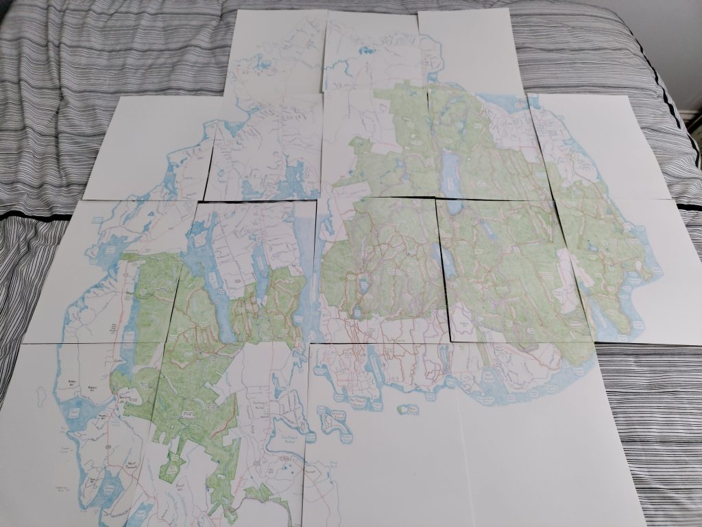
A little more than halfway through drawing the map.
Then comes the fun of erasing it all, leaving a faint outline behind to use to color everything in with colored pencils. Typically this process of coloring will take anywhere from three to six months, as I’ll also draw in the legend, logo, scale bar, north arrow, etc at this point. At this point to finish the map I’ll tape the sheets together, lining up the sheets as best as possible.
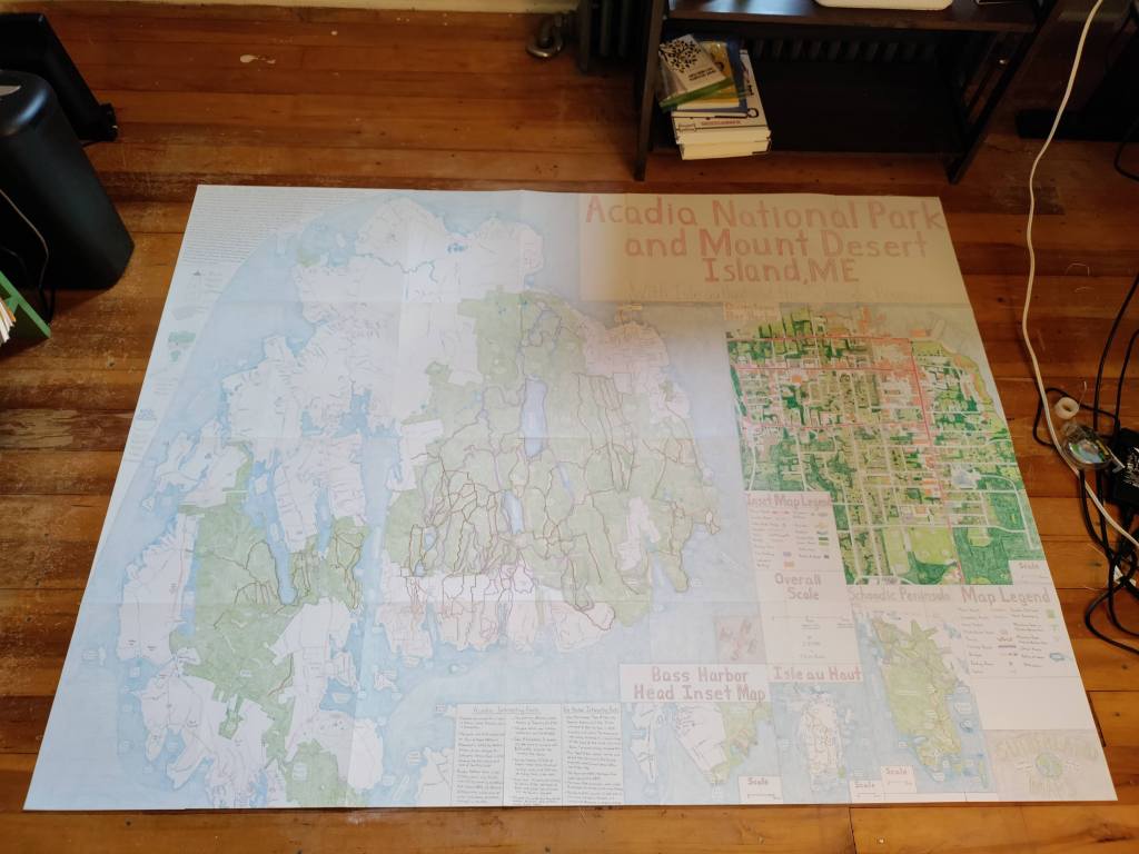
The final map taped together before scanning.
Something that I’ve done on more recent projects is scanning the maps at DRS Imaging and print in Doylestown. Their high quality cruse scanner has produced digital images of my maps for printing. before that step though I’ll digitally remove the paper lines in Adobe Photoshop, another rather time-consuming step that’s well worth it.
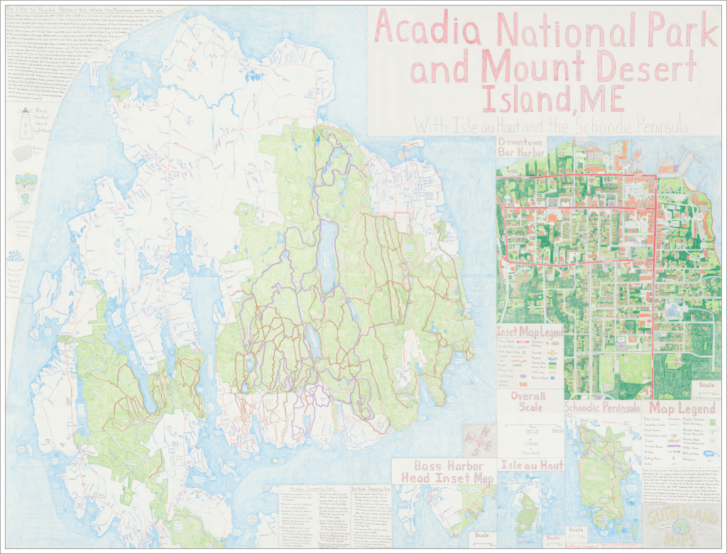
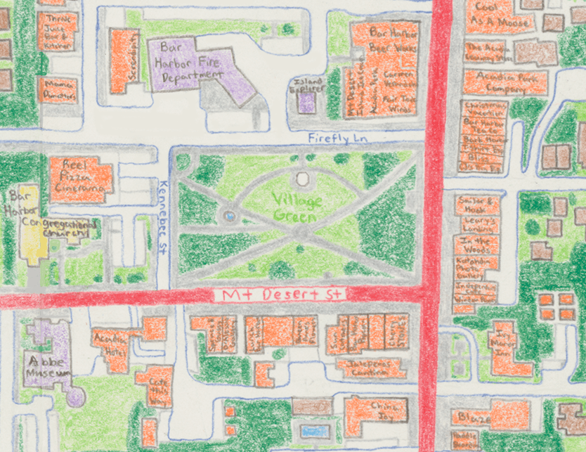
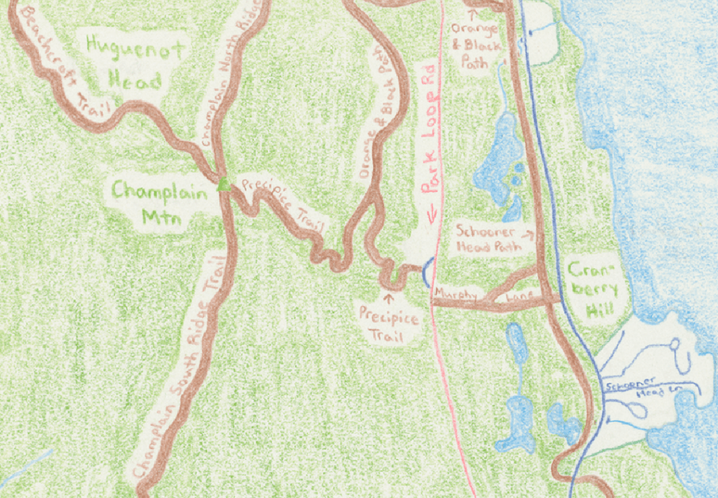
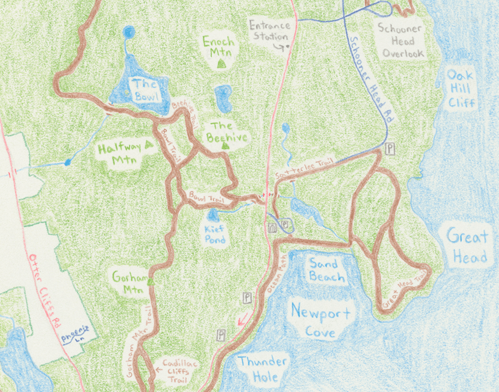
And before you know it we have a beautiful map of a national park many people treasure. If you’re interested in copies of the Acadia map you can find it here on Etsy or on Worpress right here.