Why of all places Michigan for my next map? Good question! Most maps I’ve created have been places I’ve visited/lived in. To me exploring a place is the motivation I need to make a map of it. After seeing how well the Pennsylvania state map sold at a recent craft show I wanted to do another state. Growing up I visited Michigan often, mostly around Grand Rapids to see family. During those trips we’d go to Lake Michigan, ride our bikes around Mackinaw Island, canoe across lakes and much more. The more I’ve explored the state the more making a map of it just made sense.
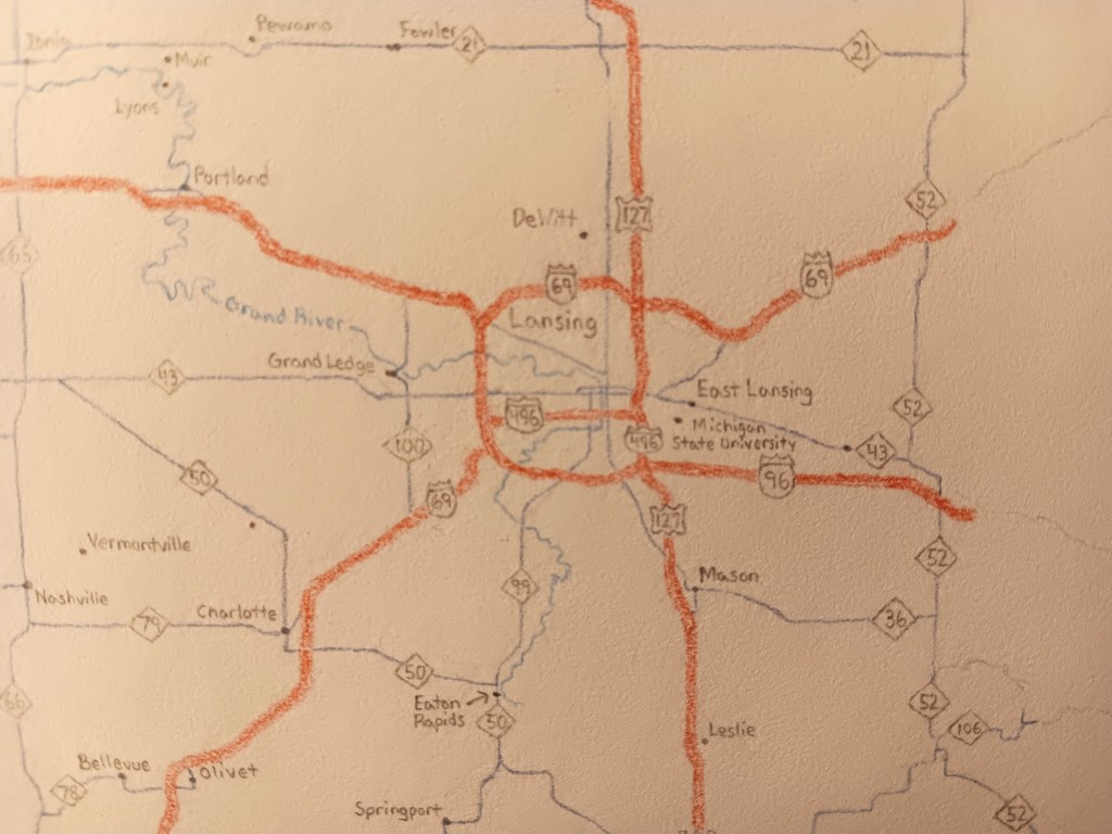
I’ll only cover the lower peninsula in this map. An 18 by 24 in sheet of paper fits that area well. If I included the Upper Peninsula I’d miss out on many details I was hoping to capture such as small towns, state parks, and possibly longer distance hiking/biking trails. Currently I’m halfway through coloring the state as seen below (Also, please excuse the image quality. Cell phone cameras can only do so much).

My process here so far has been the similar to most maps. I did use GIS software though to visualize how the map would look in a 18 by 24in layout. I took a few measurements for where certain cities, boundaries, highway interchanges, etc should be. From there I then started sketching the map in pencil before going back, erasing it, and using color pencil to now fill in the state details.
At this point I hope to finish the map by the fall. With life’s busyness that estimate may change but as long as get in a few hours a week it should be doable.

Anything you’d like to see included in the map? I’m always open to suggestions. Until then happy mapping!
